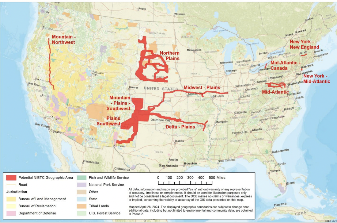
You can read their list here.
There is also a larger map of each preliminary NIETC, and DOE's initial reasoning for including it on the list.
There are 10 potential corridors across the nation ranging in size up to 100 miles wide and 780 miles long.
I'm just going to concentrate on a couple for this blog.
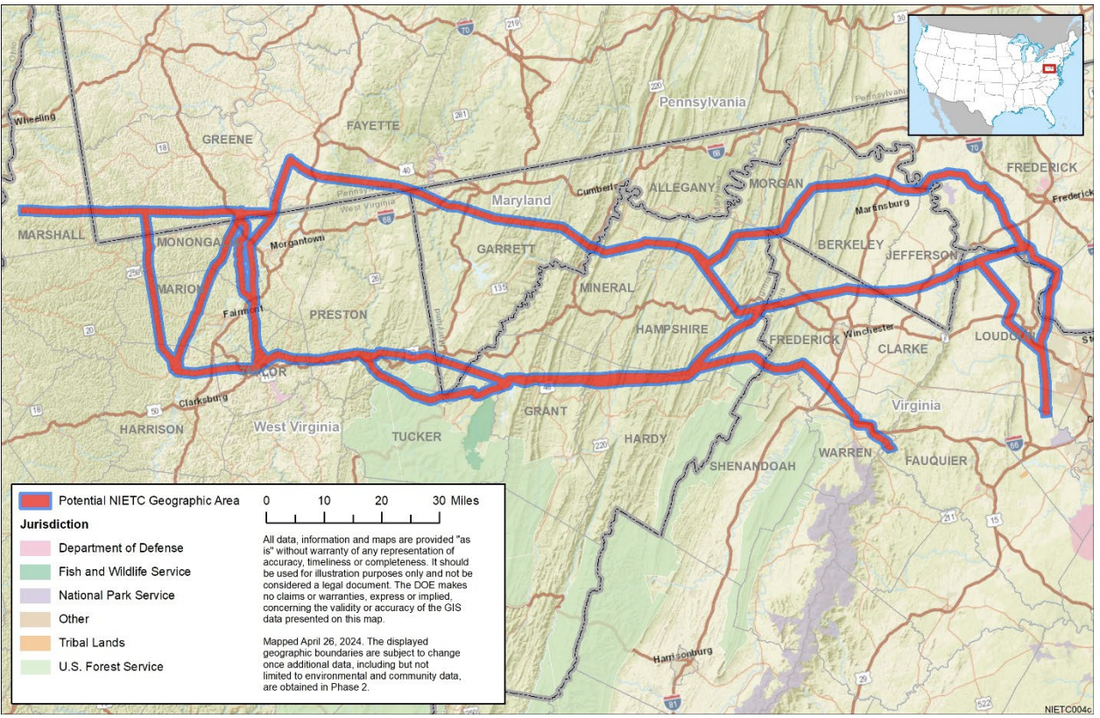
The Mid-Atlantic corridor. This corridor follows the path of the MidAtlantic Resiliency Link (MARL) project that PJM ordered to be built to act as a giant extension cord from West Virginia coal-fired power plants to Northern Virginia's data centers. But this corridor isn't just for that project... it also includes corridors for the other two large 500kV transmission lines that ship power to the east.
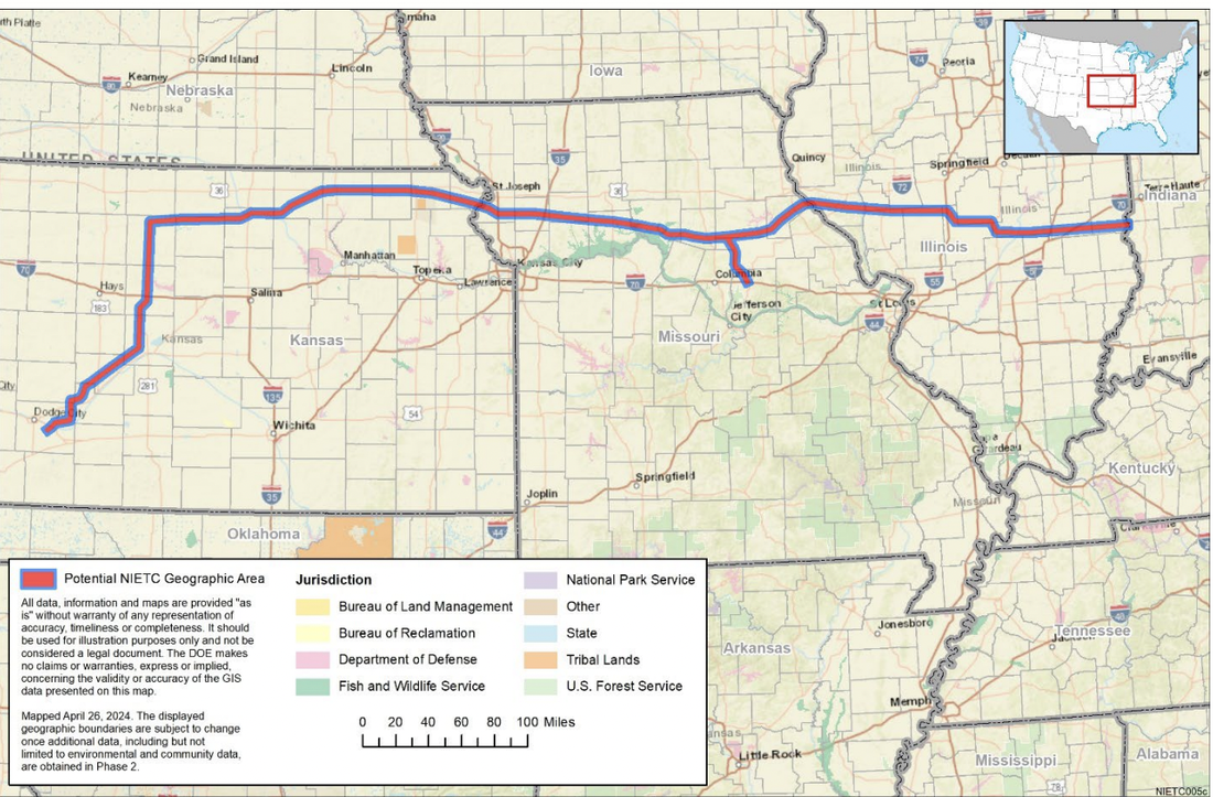
Another is the Midwest Plains corridor. This NIETC is 5 miles wide and 780 miles long and roughly follows the proposed path of Grain Belt Express.
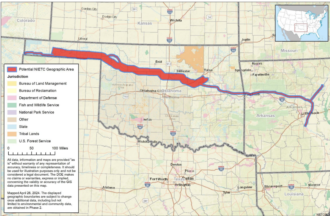
The last corridor I'm going to focus on is the Delta Plains. This corridor begins in the Oklahoma panhandle and proceeds east across the state and on into Arkansas, where it forks north and south. This corridor is 4-18 miles wide and 645 miles long. It roughly follows the routes for the dearly departed Clean Line Plains and Eastern project and the WindCatcher project. Although both of these projects were cancelled long ago, it seems that someone wants to bring the zombies back.
DOE has opened a 45-day comment period on these corridors before it will further narrow them down and select some or all of them to proceed to its next phase of the process. That phase will open environmental impact reviews, provide public notice, and issue a draft designation report that you can comment on. Of course, by the time these corridors get that far, DOE will have already made its decision. It is imperative that we all get involved and comment now.
I will be publishing more guidance for impacted landowners to help them make timely and effective comment, so stay tuned!


 RSS Feed